
Utah is an other-worldly kind of beautiful – which is probably why series like Westworld were filmed there. The state encompasses five national parks: Arches, Bryce Canyon, Capitol Reef, Canyonlands, and Zion. I’ve been there a couple of times a while back, so when I needed a break from the monotony of working from home, Utah felt like an easy choice. I knew I was going to see beautiful scenery and spend a lot of time outside.
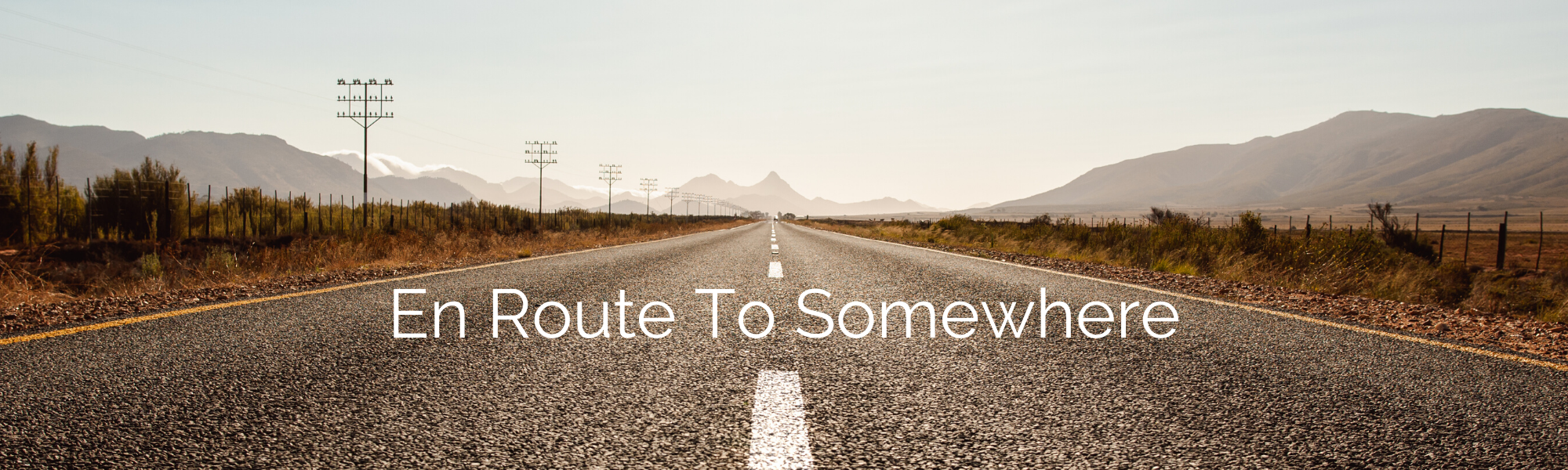
Below is an account of what I did over four days, with a travel buddy and a rental car. We flew into Salt Lake City and rented a car to drive around for a few days. I was especially excited about going in the winter because the parks aren’t as crowded, hotels are cheaper, and the scenery is still just as stunning!
Day 0: Arrive in Salt Lake City
- Arrive, settle in
- Stay in Salt Lake City, UT
Day 1: Bonneville Salt Flats and Zion National Park
- Bonneville Salt Flats for sunrise
- Angels Landing hike at Zion National Park
- Stay in Page, AZ
Day 2: Horseshoe Bend and Green River Overlook
- Horseshoe Bend in Page, Arizona
- Green River Overlook in Canyonlands National Park for sunset
- Stay in Moab, UT
Day 3: Canyonlands National Park and Arches National Park
- Canyonlands National Park
- Shafer Canyon Overlook
- Buck Canyon Overlook
- Grand View Point
- Arches National Park
- Park Avenue
- Balanced Rock
- Turret Arch
- North and South Window Arches
- Delicate Arch for sunset
- Stay in Moab, UT
Day 4: Canyonlands and drive back to Salt Lake City
- Mesa Arch in Canyonlands for sunrise
- Drive back to Salt Lake City
The Budget
Per person, we paid about $685 for the whole trip (minus flights). If you’re a backpacker on a budget, this could definitely be done for less with cheaper hotels, and less indulging at restaurants.
Lodging: There are plenty of good hotels in the range of $80-$100 per night. Our total was about $450.
Rental car: for a full-size car for 4 days from Enterprise, it cost us approximately $65 per day. Our total was about $258.
Fuel: We spent a total of about $107, which ended up being way less than I expected.
Food: $30 for car snacks, $12 for breakfasts, $12 for lunches, $30 for dinners. We mostly grabbed to-go sandwiches for lunches and ate dinner at restaurants. For two people our total was about $462.
Entry fees: I highly recommend buying an annual National Parks pass. Otherwise, it will cost you $35 to visit Zion, $30 to visit Arches, and $30 to visit Canyonlands. You can buy an annual pass for $80 at the entrance to any national park. In total we paid $80 for the NPS annual pass, and $10 for parking at Horseshoe Bend.
Day 0: Arrive in Salt Lake City
There’s little fanfare here – we arrived on a Thursday afternoon, got dinner and settled into our hotel. There is no shortage of great places to eat and stay in Salt Lake City. We picked a spot closer to the airport so that we could wake up early and head to Bonneville Salt Flats for sunrise.
Day 1: Bonneville Salt Flats and Zion National Park
Catch the sunrise at Bonneville Salt Flats
We woke up and left Salt Lake City to catch the sunrise at Bonneville Salt Flats. You can hop on the I-80 west from Salt Lake City and reach the rest stop along the Bonneville Salt Flats in 1.5 hours. It’s winter, so sunrise wasn’t until about 7:30am, which meant leaving Salt Lake City at 6am. It felt a little bit like cheating to be able to sleep a decent amount and still watch the sunrise.
We found ourselves driving through a long stretch of the salt flats just before the sun broke over the horizon. There’s a rest stop right on the salt flats near Wendover that has bathrooms and water. This is where the best sunrise view is and also right near where the famous Speedway is. It was cold and windy when we got out of the car – really cold. We eventually ended up hopping back into the car and driving around on the crunchy salt a bit before heading towards Wendover.

Drive down 93S to Zion National Park
After passing through Bonneville Salt Flats, we stopped in Wendover to fill up on fuel and begin the long drive down 93S towards Zion National Park. Just as we got onto 93S we passed a sign that said the next fuel station was 130 miles – eek! The beginning of the drive winds through empty valleys with nothing but a few sheep and horses. Apparently there are ghost towns along this road – or so the bartender from the Grand America Hotel told us. I say “apparently” because we lost service and couldn’t actually consult our maps to see if there were any ghost towns farther off the road. Side note: if you spend the night in Salt Lake City, go to the Grand America Hotel’s Gibson Girls Lounge and order wings – you won’t regret it.
We passed some abandoned buildings and motels, but didn’t see anything I would classify as a ghost town. There were many stretches of road throughout this trip during which I didn’t have service. Most of the time I was diligent about downloading podcasts, and I always keep a few playlists downloaded just in case. Most importantly though, if you’re like me and rely on your phone for directions, definitely download your maps ahead of time.

Angels Landing Hike, Zion National Park
We left Wendover at about 8:30am and, with a stop for lunch, reached Zion National Park just after 3pm. The drive itself is about 6 hours. We arrived at Zion knowing we didn’t have a ton of time and that we wanted to hike Angels Landing. With that in mind, we entered the park and drove straight up to the Grotto Picnic Area to park.
The trailhead for Angels Landing starts right across the road. Trying to park at the Grotto any time before about 4pm is a gamble, but on this particular day at 3:15pm we had no competition for a parking spot. That’s probably because it was really cold, it had recently snowed (residual ice on the trails), and the sun was about to set. Parking is usually so full that the rangers at the entrance will just straight-up tell you the parking lot is full (like they did to us).

Angels Landing is an intimidating hike in the best of conditions. The photo above is just the very beginning of the hike. It’s about 5 miles round-trip and it’s steep. The last quarter mile of the hike is along the edge of a cliff with about a 1,000 foot drop on either side. The rocks can be slippery along that last stretch, so there are chains for hikers to hold onto. Suffice it to say, if you don’t like heights, you might want to sit the last portion out.

I’ve hiked Angels Landing a couple of times during summer and it’s hot, crowded and tiring, but very worthwhile for the view. Be prepared to be patient and sacrifice a some personal space as hikers squeeze past you going the opposite direction.
The late afternoon winter experience was a whole different story. The beginning of the hike is uphill, so it felt nice to complete that portion in the cooler weather. It had snowed the day before, so as we got up higher we could see that it was icy where the snow melted in the sun and refroze in the shadows. As the sun began to set, the last half mile of the hike fell into the shadows on the east side of the ridge, creating a layer of ice over the rock.
We got somewhat close to the top, but we reached a point where it was too icy and it didn’t seem wise to keep going. If you go in the winter and feel determined to hike Angels Landing, plan to bring crampons and don’t plan to stay for sunset if it’s below freezing unless you’re experienced at hiking in adverse conditions. We took in the view from not-quite-the-top and happily turned around.

The trek back down was fast, once we bypassed all the precariously icy stretches. It was dark and cold by the time we got back, making us extra happy we had scored a parking spot right at the trail entrance. We left Zion National Park, and started the 2 hour drive to Page, AZ. It was a dark and uneventful drive.
Day 2: Horseshoe Bend and sunset at Canyonlands
It was dark by the time we arrived in Page, so we found somewhere to get food and checked into our hotel. It seemed like most places were closed by the time we arrived anyway and we were generally happy to go to bed early and wake up early.
Horseshoe Bend in Page, Arizona
We drove about 5 miles from Page to Horseshoe Bend. We arrived mid-morning, hoping to catch the canyon after the harsh morning shadows eased up, but before the noon sun filled in all the cracks and everything started to appear flat. By about 10:30am the shadows softened and I was able to get some beautiful shots.

We left Horseshoe Bend by about 11:30am and started the drive to Moab. We stopped for lunch along the way and, by the time we approached Moab, we decided to just head to Green River Overlook in Canyonlands for sunset.
Green River Overlook in Island in the Sky District, Canyonlands
Green River Overlook is in Island in the Sky District in Canyonlands, which you can access from the north end of the National Park. The drive from Horseshoe Bend took us just over 5 hours. The signs inside Canyonlands are clear and helpful, so we easily found the parking for the overlook about 8 miles past the visitors center.

This view felt infinite and so golden. The canyon below was shades of soft gray, in contrast with the saturated sky. I’m sure there are many other overlooks in Canyonlands that would have been equally as stunning for sunset, but this view was such a treat, especially after being cooped-up in a car all afternoon.
If I could do this again, I probably would go to Needles District for sunset instead of Island in the Sky. That drive would have been 4.5 hours in total. The entrance to Needles District is south of Moab just off US Highway 191, so it would have been more on the way to our hotel. Unfortunately, we just didn’t quite plan well enough to realize that would have worked before we passed the entrance. I also thought that maybe we could get to Needles from Island in the Sky, but there aren’t any roads that directly connect the two districts. If you want to visit Needles and Island in the Sky, you really should aim to spend 2 days in Canyonlands.
Day 3: Canyonlands and Arches National Parks
Let me just caveat this by noting that you definitely can see both parks in one day, but not if you want to do any substantial hiking. Our priorities were the overlooks in Island in the Sky in Canyonlands, and the arches and a few view points in Arches. That plan worked out beautifully for us, but I think the dream would be to have 4 full days to conquer both parks and do a few more long hikes.
Tips for visiting Canyonlands and Arches
- Pack your lunch. That way you can spend the day site-seeing without driving back to Moab in search of food.
- Stop at the visitor center and pick up a newspaper/brochure. It has helpful updates and detailed information and recommendations.
- No flying drones.
- Don’t plan to have cell service – download any maps, playlists and podcasts in advance.
- Bring enough water for your whole stay. Note that Island in the Sky campground in Canyonlands doesn’t have water.
- Consider camping – Island in the Sky ($15 per night) and Needles ($20 per night) districts have campgrounds.
- Stay up late and star-gaze. In the winter, the stars are out in force by 6:30pm!
Canyonlands National Park
Canyonlands has three districts: Island in the Sky, Needles and the Maze. Island in the Sky is the northern-most district and most heavily trafficked. It’s a 1,000-foot high mesa, which makes for stunning views at almost every stop. There are off-road opportunities, but most of this district is easily accessible via paved roads and overlooks that are less than a 1/4 mile walk from parking.
Needles and the Maze aren’t familiar to me because I haven’t yet had the opportunity to visit. Needles is about 2.5 hours from the Island in the Sky visitor center, but if you are driving north to the park, it’s on your way – just south of Moab along Highway 191. Unfortunately, there aren’t roads that connect the districts, so if you want to visit multiple districts, you’ll have to drive a couple hours or more to commute between entrance points. The Maze is definitely the hardest district to visit and it requires the most planning. It’s not a day-trip kind of place. You’ll need a high-clearance 4wd vehicle to explore the Maze.
The first thing we did before heading from Moab to Canyonlands was to go eat breakfast and grab to-go sandwiches for lunch at a shop in Moab. We knew we were going to spend all day driving/walking around and we wanted to be able to eat our lunch in the park. With our sandwiches packed up, we started the 35-minute drive from Moab to Island in the Sky.
The Canyonlands Overlooks
We were able to visit Shafer Canyon Overlook, Buck Canyon Overlook, Orange Cliffs Overlook, and Grand View Point Overlook. We took our time taking photos and walking around, but we were still able to see a lot because the viewpoints are so close to the road.

When we arrived at Canyonlands mid-morning, the canyons were filled with dense fog – it was magical, but I’m not actually sure how common this is. Shafer Canyon Overlook is a short drive from the visitors center (maybe less than a mile). Our tactic was to just keep driving and stop at any overlook that inspired us to pullover.

Buck Canyon Overlook is 6 miles past Mesa Arch. We bypassed Mesa arch because we planned to come back for sunrise the following morning.

Orange Cliffs Overlook is on the west side of the road near Buck Canyon Overlook. I’ll admit this view was slightly less spectacular than the other overlooks we visited, but that might be partly because the landscape is flatter and the canyon was filled with clouds.

This view really is amazing. You can see the contours of the canyon below so clearly and it seems to surround you as you walk out to the viewing point. If you drive straight to Grand View Point from Moab, it would take about an hour – it took us longer because we stopped at other overlooks along the way. This would be a really great spot to watch the sunrise.
Arches National Park
Early afternoon, we drove over to Arches National Park. It’s almost right across the street from the entrance to Island in the Sky District in Canyonlands, so it actually felt pretty easy to visit both in one day. If I had more time, I would have liked to spend an additional 2 days in Moab to visit Needles and to venture farther north in Arches National Park up towards the Devil’s Garden Primitive Loop Trail.
If you plan a road trip through Utah in the winter and find yourself in Arches, check on trail closures before you go. Some of the trails, particularly Devil’s Garden and Delicate Arch, can be dangerous when it’s icy. The NPS website will list closures as they occur.
Park Avenue and Balanced Rock
After passing the visitor center, this is the first pull-off we came across. Park Avenue is both a hike and a viewpoint. The hike is about 2 miles in total, straight out through the valley and back.

After leaving the Park Avenue viewpoint, we continue up the road to Balanced Rock. Balanced Rock is a hard sandstone rock balanced on portion of a softer mudstone formation. Because mudstone is softer, it erodes faster over time and creates this balanced effect. Formations like this can be found all over the park.

Double Arch, the Windows and Turret Arch
Just a bit farther up the road from Balanced Rock, you can take a right turn towards the Windows, Turret Arch and Double Arch. The arches in the park formed as water collects in deepening potholes and seeps into the rock below. Eventually the pothole and the alcove below connect and form an arch. These arches will be around for a while (understatement), but after a very long time of widening, they’ll eventually collapse. If you walk the quarter-mile trail from the Windows parking lot to Double Arch, you’ll feel very small under this arch measuring 144ft by 112ft.

North and South Window Arches are just on the other side of the parking lot from Double Arch. The loop around these arches, appropriately called Windows Trail, takes you right by Turret Arch and is about 1.1 miles in total.


Hiking to Delicate Arch
Delicate Arch is one of the most iconic arches in the park. The hike to the arch is about 3 miles round-trip and is a mild incline, mostly over smooth rock. In the winter, that incline is definitely enough to warm you up! This trail can get icy in the winter, making it too dangerous for hikers, so check for closures ahead of time. Whether you hike this in the winter or summer (I’ve done both), you’ll need to bring plenty of water. The sun can be intense and there’s hardly any shade.

We opted to stay in Arches National Park until after sunset to watch the stars. The stars begin to appear before the sun has completely set. We sat up on the rock formations at Delicate Arch with a few other stragglers and chatted while we tried not to freeze. By 6:30pm we were able to start getting some good night photography. We ended up re-visiting a few arches, so I plan to turn that into a whole separate post. On the whole, the night was cold, peaceful, beautiful, and a perfect last night of our Utah road trip.
Day 4: Sunrise at Canyonlands and return to Salt Lake City

We woke up early and headed to Mesa Arch for sunrise. To get into the park we drove north on 191 from Moab and turned onto 313. It’s a simple drive, which is so welcomed when you have to start driving before the coffee kicks in. Simple drives always make road trips feel less stressful. The half-hour drive along 313 in the early morning was unbelievable. Well before the sun rises, it creates a bright orange-yellow ribbon along the skyline. It was so bright I was almost worried we were going to miss the sunrise. As we were driving I kept feeling like we could have pulled over anywhere and had an amazing view of the sunrise. This drive is definitely worth waking up early for.

Mesa Arch is a popular sunrise spot, so even in the middle of the winter there were a lot of people there. If you aren’t totally set on getting that iconic photo and want to watch the sunrise in peace, then I’d recommend going to one of the other overlook view points. Shafer Overlook or Grand View Point would be great alternatives.
After we got our fill of the view, we retreated to the car and started the drive back up to Salt Lake City to catch our flight and end our Utah road trip.


16 comments
Love this road trip route! That Shaffer Canyon Overlook with the clouds/fog is awesome! I did this trip in the summer and it also looks lovely in the winter. 🙂
Me too! We were so pleasantly surprised by the fog – and also not sure how often that happens. Utah is definitely awesome in the summer too!
The beauty of the southwest really comes through in this post. The photo of Mesa Arch is otherworldly. I love these parks and you have represented them well.
Thanks Karen! I suppose that’s a huge part of the reason why Mesa Arch is such a popular sunrise spot. It’s definitely unreal. Thanks for reading!
Love this itinerary! Never been up to Salt Lake City, but hope to see the Bonneville Salt Flats and more.
I hope you get a chance to make it to Bonneville Salt Flats next time you’re anywhere near the area. It’s such a lovely spot for sunrise.
I would love to visit those salt flats on a trip here, and of course the hiking trails all look incredible too.
Thanks Krista! The Salt Flats were one of my favorite things – and it’s an easy morning visit if you fly into Salt Lake City, which is what I ended up doing. An yes, the hiking trails throughout Utah are incredible!
You have managed to pack so many amazing things in this weekend road trip. Whilst I love hiking, I don’t think I would dare to attempt Angel’s landing because of the ridge at the end, that would trigger my fear of heights for sure. I would however love to hike around the Arches and the Canyonlands. The views from there are breathtaking.
It did entail a lot of driving, but it was so worth it! And I don’t blame you for not wanting to attempt Angels Landing – the view from partway up that hike is still amazing though. 🙂
What an incredible road trip! Utah has so many stunning National Parks! I’ve never visited in person but the photos always blow me away, the landscape is so otherworldly! I’d love to try out this road trip and explore the national parks one day. Although I have to admit, as someone who suffers from vertigo, my head is reeling from just looking at that photo of Angels Landing Hike! Unfortunately, I think I’d have to give that one a miss! Thanks for the great guide!
Thanks Hannah! Angels Landing is definitely a little daunting, but Zion has a lot of other beautiful hikes – I’ve done some of them in past trips. I hope Utah makes it on your travel list in the upcoming years!
Utah is seriously so incredible! I did a road trip there this past summer and loved it all. The only thing is that I need to return and do Arches and Canyonlands. Great article! 🙂
I totally agree – it is incredible! And, it’s so lovely in the summer (and it’s easier to spend hours on end outside). Thanks for reading!
Wow your pics are stunning. You have inspired me to take this road trip. Utah has been on my list for awhile. This might be the year to visit. Excellent post and pinning so I have this guide when I go.
Thank you – it’s definitely lovelier in person than in any photos! I hope it makes your travel plans this year. Thanks for reading!